|Ganjam|Jajpur|Jagatsingpur|Jharsuguda|Kalahandi|Keonjhar|Kendrapada|Khurda|Koraput|
|Mayurbhanj|Malkangiri|Nawarangapur|Nayagarh|Nuapada|Kandhamal|Puri|Rayagada|
|Sambalpur|Sonepur|Sundargarh|
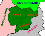
It is a new district.Two rivers Mahanadi & Bramhani rush through the district making it fertile. Angul is well discovered for its hotspring named Athamallik. It is rich with the resources like coal mines, Thermal power Project plant, fertilizer factory and heavy water project. The ranger's training and Police training colleges also exist here.Baranpal, Bhimkund, Binikei, Bulajhara, Deulajhari, Handapa-Patrapada, Hingula Pitha, Khuludi, Rengali, Talcher and Tikarapara are some of the places of tourist interest.
Important Places
Talcher : It is situated at a distance of 65 km from Bhubaneswar ,famous for coal mines,thermal power project, fertiliser factory, heavy water project.
NALCO Nagar : It is famous for Aluminium factory.
Tikarapada : Situated at a distance of 60 km from Angul, Tikarapada attracts the tourists for its Gharial Crocodile Sanctuary and Satakosia George of river Mahanadi around amidst lush green forest.
Bhimkund : One can see the sleeping statue of Lord Bishnu which is at a distance of 28km from Talcher.
Deulidhar : Deulijhar is the hotspring which is situated at a distanc eof 5 km from Athagarh.
General Information About Angul District
Area 6,232Sq.Kms.Forest 2716.82Sq.Kms.Population 11,39,341 Literacy Rate 69.40%
Head quarter Angul Vidhansabha seats 4 Sub division 4 Villages 1922 Blocks 8 Grama panchayat 180 municipality 1 Towns 9 N.A.C 1 Temperature 43.9(Max), 14.6 (Min)
Tahasils 5 Rainfall 1255.2mm(avg)
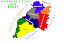
Blocks 1. Angul sadar 2.Athamalik sadar 3. Chhendipada 4. Talcher sadar 5. Pallahada sadar 6. Banarpal 7. Kishorenagar 8. Kanhia
Tahasils 1. Angul 2. Athamalik 3. Talcher 4. Pallahada 5. Chendipada
Subdivisions 1. Angul 2. Athamalik 3. Talcher 4. Pallahada
Balasore is famous for its forests and mines.This district is noted for the river Buhdabalanga and 3,824 feet high mountain Mahagiri . It is also bestowed with the Chandipur sea Beach and Subarnarekha irrigation project. Balasore is appreciated for its salt, Brass utensils, stone and clay works.
Ayodhya, Balaramgadi, Bardhanpur, Bhusandeswar, Chandaneswar, Chandipur, Kasaphal, Langaleswar, Laxmannath, Panchalingeswar, Raibania, Remuna, Sajanagarh, Talasari, Tripisagadia and Kupari are some of the places of tourist interest.
Important Places
Remuna : Situated at a distance of 8 km from Balasore.It is famous for khirachora Gopinath Temple.
Chandipur : Chandipur is a peaceful sea side resort where the sea and proceed 5 km everyday -16 km from Balasore.Other places of tourist interest around Balasore are Remuna , Panchalingeswar, Aradi and Chandaneswar.
Panchalingeswar : It is situated on a hillock at a distance of 40 km from Balasore. It is the seat of Lingam, known as Panchalingaswar with the perennial spring flowing over them are the added attraction of this place.
Chandaneswara : It is situated at distance of 88 km from Balasore .This religious center is famous for the Temple of Lord Chandaneswar.
Raibania : This picnic spot is situated at distance of 75 km from Balasore.It is a historical place and the visitors can see the ruins of Raibania forts.
Digha : The tourist can see the lonely sea and the charming beach found here.It is the border place of Westbengal and Orissa.
General Information About Balasore District
Area 3,634Sq.Km. Forest 332.21 Population 16,96,583 Literacy Rate 70.94
Head quarter Balasore Vidhansabha seats 12 Sub division 2 Villages 2,971
Blocks 12 Grama panchayat 257 Municipality 1 Towns 4 Police Station 19 Fire Station 5
N.A.C 4 Temperature 43.1(Max), 10.6(Min) Tahasils 19 Rainfall 1832.3mm (Avg)
Blocks 1. Bhogarai 2. Simulia 3. Balasore sadar 4. Khaira 5. Soro
6. Bahanaga 7. Remuna 8. Baliapal 9. Jaleswar 10. Nilgiri 11. Nilgiri sadar
Tahasils 1. Baleswar 2. Busta 3. Nilgiri 4. Jaleswar 5. Soro
subdivisions 1.Baleswar 2.Nilgiri
Baragarh got the recognition of a district on April 1st 1993. This is one of the districts of western Orissa which is developed in agriculture, industry, and trade. Bargarh is known as a prosperous district as it holds the Hirakud Irrigation Project. Mahanadi, Jira, Jhanu are some of the rivers that flow through the district making it a heavenly place. Baragarh is rich with the resources like Sambalpuri handloom works cottage industry, Cement factory, Sugar factory and spinning mills. Bargarh is well known for its Dhanu Yatra and Bandha cottage industry.
....... Debrigarh, Devdarha, Gaisima, Ganjapali, Nrushimhanath and Papanga are some of the tourist centres of Baragarh district.
Important Places
Kedarnath Temple : This temple is situated at a distance of 36km from Baragarh at the foot of Bara hill. This temple was built by Sri Dakhsin Ray, the dewan of Ajit Singh, the king of Sambalpur between 1695 to 1765.It is one among the AstaSambhu temples. Behind this temple there exists the remains of of Kedarnath fort.
Nrusinghanath Temple : This temple is the most famous temple of Baragarh district. It is situated at a distance of 110 km from Baragarh. This temple was built by Sri Baijal Dev Bikari, the king of Patana during fourteenth century. This temple is famous for its statues carved on its outside wall.
General Information About Baragarh District
Area 8,834 Sq.Km. Forest 1216.13Population 13,45,601 Literacy Rate 64.13%
Head quarter Baragarh Vidhansabha seats 5Sub division 2 Villages 1208Blocks 12
Grama panchayat 196 Municipality 1 Towns 3 N.A.C 2Rainfall 145.9mm(Avg)Tahasils 7
Blocks 1. Baragarh sadar 2. Barpali 3. Veden 4. Atabira 5. Bhatli
6. Ambadoni 7. Bijepur Sohela 8. Paikamala 9. Jharbandh 10 . Gaisilat 11. Padmapur sadar
Tahasils1. Baragarh 2. Padmapur 3. Atabira 4. Sohela 5. Barapali 6. Veden 7. Bhatil.
subdivisions1. Baragarh 2. Padmapur
Situated at a distance of 159 kms. from Bhubaneswar,it is famous for Bhadrakali Temple . It has been separated from Balasore and thus is a new district born in the year 1993. Salandi river passes by this district. This district has contributed equally like the other older districts in cultural, economicL, Social and Political fields. This district had also contributed a lot during the freedom struggle of our motherland.
........Aradi, Chandabali, Dhamanagar, Dhamara, Guamala Nuasasan, Arharpada(Bhadrakali) and Ishwarpur(Dappanaikani) etc are some of the places of tourist interest.
Important Places
Patiala : Patiala which is situated 15 kms. from Bhadrak is famous for Biranchi Narayana Temple.
Sri Radha Madanmohan Temple : This temple is one of the most visited temples of Bhadrak district. The uniqueness of this temple lies in the fact that Sri Chaitanya's five hundred old clothes are present here.
Chandbali Port : Chandbali port occupies a distinct place in Orissa's trade and navigation.
Dhamara Port : Dhamara Port is not yet complete. It is the second port of this district. This port when completed will stand as a mile stone in India's as well as world trade.
Aradi : Situated at a distance of 10km from Chandabali, Aradi is famous for the temple of Akhandalamani.
General Information About Bhadrak District
Area 2,677Sq.Km. Forest 97.07Sq.Kms.Population 13,32,249 Literacy Rate 97.07%
Head quarter Bhadrak Vidhansabha seats 5 Sub division 1 Villages 1,307Blocks 7 Grama panchayat 166 Municipality 1 Towns 3 N.A.C 3 Temperature 42.8(Max), 11.4(Min)
Tahasils 6 Rainfall 1451.6mm(Avg)
Blocks 1. Bhadrak sadar 2. Basudevpur 3. Chandabali 4. Tihidi
5. Bhandaripokhari
Tahasils1. Bhadrak 2. Chandabali 3. Basudevpur 4. Tihidi 5. Dhamanagar
subdivisions 1. Bhadrak
Is one of the major commercial townships in the western part of Orissa. Bolangir includes elegant temples along with the hill Gandhamardan. On this hill there exists an exquisite picnic spot called Harishankar. Several unique monuments in addition to a couple of waterfalls serve in calling the attention Of tourists. Bolangir district is honoured for the important visiting places like Harisankar, Chandra, Papakshya Ghat, Nabagraha Kunda, Debi Chandlipat, Turekela, Jogisarada and Ranipursarial.
Important Places
Harisankara : It stands at the foot of the picturesque gandhamardana hill at a distance of 140 km. from the Sambalpur.The 15th centuary Vishnu temple ,Bhairabi temples having an inscription with the porto-Oriya script and papanasi spring are the visiting places of Harisankar.
Charda : It is situated at a distance of 4 km. from Binka .It is famous for Kapilaswar Temple.
Papakshya Ghat : It is situated at a distance of 4 km. from Binka. It is famous for Radhakrusna temple and Banhha Bata.
Nabagraha kunda : It is famous for stone images of Nabagraha.
Jogisarada : It is siated at a distance of 25 km. from Balangir is famous for Jogeswar temple. The temple of Goddes Lankeswari is situated on hillock. and also there are so many temples situated at patnagarh. It became a new district recently.
Debi chandlipat : It is situated at a distance of 11 km. from Binka. Its turnel way is famous.
Ranipur jharial : It is situated at a distance of 29 km. from titlagah. It is famous for 64 yogini andvisnuTemples .
General Information About Bolangir District
Area 6569Sq.Km. Forest 1543.85Sq.Kms Population 13,35,760 Literacy Rate 54.93%
Head quarter Bolangir Vidhansabha seats 5 Sub division 3 Villages 1792 Blocks 14 Grama panchayat 241 Municipality 2 Towns 4 N.A.C 3 Temperature 46.1(Max), 3.1(Min)
Tahasils 4 Rainfall 1215.6mm(Avg)
Blocks1. Balangir sadar 2. Tentulikhunti 3. Deogaon 4. Puintola
5. Loisingha 6. Agalpur 7. Patnagarh 8. Belpada 9. Khaparakhol 10. Turkela
11. Bagamunda 12. Muribahal 13. Saintala 14. Titilagarh sadar
Tahasils 1. Balangir 2. Titilagarh 3. Patnagarh 4.Rampur 5. Kantabanji 6 . Tusara
Subdivisions 1. Balangir 2. Titilagarh 3. Patnagarh
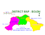
It is separated from Kandhamal and become a new district in recent times.It is at a distance of 70Kms from Kandhamal. Boudh district is touched by the rivers Mahanadi and Rushikulya. An image of Lord Budha known as 'Bhumisamudra' is situated here.
Boudh, Charichhak(Puruna Katak) and Charisambhu are some of the visiting places of Boudh district.
Important Places
Charisambhu : It is famous for Bishnu Temple.
Puruna Cuttack : Situated at a distance of 40 km from Kandhamal is famous for the tepmle of Goddess Vairabi.
Padmatola : A wildlife sanctuary of Boudh district.
General Information About Boudh District
Area 3444Sq.Km. Forest 1277.17Sq.Kms.Population 3,73,038 Literacy Rate 58.43%
Head quarter Boudh Vidhansabha seats 3 Sub division 1 Villages 1156 Blocks 3 Grama panchayat 58 Municipality 1 Towns 1 N.A.C 2 Rainfall 115.3mm(Avg)Tahasils 2
Blocks 1. Kantamala 2. Harabhanja 3. Boudh sadar
Tahasils 1. Kantamala 2. Boudh
subdivisions 1. Boudh
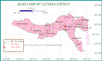
One of Orissa's oldest cities ,better known as the Business Capital of Orissa .It offers gold and silver filigree works, horn and brass work, silk and cotton textiles and leather works. This city has river Mahanadi in the north and river Kathajodi in the south. Those who are fascinated by history are drawn to the ruins of the Barabati Fort. Nearby is the shrine of Kataka Chandi , the presiding deity of the city.The Ravenshaw College, High Court, S.C.B Medical, All India Radio Centre, Central Rice Research Institute, Stone Revetment, Temple of Goddess Chandi and Barabati Durga are the main visiting places. Cuttack is also recognized for its Paper mills, Sugar factory, Tile factory, glass and china clay factory, jute mill and spinning mills.
.........Ansupa, Banki, Bhattarika, Choudwar, Dhabaleswar, Kukudiapada, Kukudanga, Lalitgiri, Naraj, Nemala, Niali Madhab, Satakosia, Simhanath and Paramhansa are some of the places of tourist interest
Important Places
Dhabaleswar : It is situated at a distance of 7 kms. from Cuttack on the bed of river Mahanadi. It is famous for the Dhabaleswar temple . A large festival is celebrated here in the Kartik(November month).
Qadam- I- Rasool : Situated in the centre of the city it is sacred to the Hindus as well as the Muslims. This 18th century shrine shelters the footprints of Prophet Mohammed on a circular stone in its central mosque. There are two more beautiful mosques and a music gallery.
Paramahasanath temple : People visit the Paramahansanath of Shiva on a holy day . The temple on the outskirts of the town is famous for its water hole (Ananta garva),which floods the sanctum santorum on holy occasions.
Banki : It is situated at a distance of 60kms. from Bhubaneswar .A temple is situated on a hillock in that place dedicated to the Goddess Charchika .River Mahanadi flows through the town.
Mahavinayak : At a distance of 2 kms. from Chandikhol to the West is the seat of famous Ancient Shiva temple of Mahavinayak.
Chhatia : It is situated at the distance of 35 kms. from Cuttack. It is famous for Lord Jagannath Temple.
Baneswar : It is situated on the bed of the river Mahanadi and is famous for the Shiva temple and the tourists can enjoy the beauty of the nature.
Niali-Madhab : It is situated at the distance of 42 km. from Cuttack. It is famous for the temple of Sovaneswara Shiva.
Ansupa : It is a beautiful lake and is situated at the distance of 60kms. from Cuttack. The Charming nature attracts the Tourists.The lake is a heaven for migratory birds in winter. The lake offers facilities for boating and fishing .
Naraja : This is one of the scenic spot on the bank of the Mahanadi in the south,which boasts of many Buddhist images. It is 15 kms. from Cuttack.
Bhattarika : This charmin scenic spot on the Mahanadi valley is situated at a distance of of 90kms from Cuttack. It is famous for the temple of Goddess Bhattarika.
Niali Mahdab : Situated at a distnace of 42kms from Bhubaneswar, Niali is famous for the temple of Sobhaneswar(Shiva) and Madhab(Vishnu).
General Information About Cuttack District
Area 3,733Sq.Km. Forest 163.65Sq.Kms. Population 23,40,686 Literacy Rate 76.13%
Head quarter Cuttack Vidhansabha seats 10 Sub division 3 Villages 1865 Blocks 16 Grama panchayat 274 Municipality 1 Towns 9 N.A.C 2 Temperature 42.0(Max), 7.5(Min)
Tahasils 10 Rainfall 1587.4mm(Avg)
Blocks 1. Salepur 2. Banki sadar 3. Athagarh sadar 4. Tigiria
5. Narasinghpur 6. Gobindpur 7. Baramba 8. Kantapada 9. Niali 10. Mahanga
11. Cuttack sadar 12. Tangi 13. Dampada 14. Krisnanagar 15. Baranga 16. Choudwar
Tahasils 1. Athagarh 2. Banki 3. Baramba 4. Darpani 5. Narsinghpur
6. Choudwar 7. Tangi 8. Tigiria 9. Niali 10. Cuttack
Subdivisions 1. Banki 2. Athagarh 3. Cuttack
It is situated at a distance of 97 km. to the east of Sambalpur. It became a new district from Ist january 1994. The pradhanapat waterfall on the Padhanpat hill, close by the town is a place of scenic beauty .
General Information About Deogarh District
Area 2,784Sq.Km. Forest 1100.26Sq.Kms. Population 52,74,095 Literacy Rate 60.78%
Head quarter Deogarh Vidhansabha seats 1 Sub division 1 Villages 867 Blocks 4 Grama panchayat 53 Municipality 1 Towns 1 N.A.C 0 Temperature 46.1(Max), 3.1(Min)
Tahasils 1 Rainfall 1529.9mm(Avg)
Blocks 1. Deogarh sadar 2. Barkot 3. Raimal 4. Teleibani
Tahasils 1. Deogarh
Subdivisions 1. Deogarh
Dhenkanal is a town with a cluster of temples and archaeological remains. Kapilash , the serene hill of epic fame houses the hilltop shrine of Lord Chandra Sekhar Shiva with a cluster of other temples and a mediaeval fort.The foothill is perched with a Deer Park, a Scence Park and a Panthasala-26 km from Dhankanal .Joranda(24 km) is the religious headquarters of Mahima Cult.11 km south -east of Dhenkanal town is Saptasajya , a hill of uncommon scenic charm- ideal for outing.
.........Joranda, Kapilas, Kualo, Ladagarh, Ramail, Saptasajya and Saranga are some of the visiting places of the Dhenkanal district.
Important Places
Kapilash : It is situated at a distance of 24 km from Dhenkanal. It is famous for Chandrashekar Shiva Temple which is situated on a hillock. The captivating natural scenery attracts the visitors. A deer park is situated nearby.
Saptasajya : It is situated at a distance of 12 km from Dhenkanal. It is the place of scenic beauty and is famous for Saptarisi(seven sages) and Raghunath .In Mahabharat ,it is said that 'the Pandavas' had taken rest here.
Deulijhar : It is situated at a distance of 12 km from Dhenkanal. It is famous for the Mahima Temple and the seat of Mahima Dharma.
Tikarapada : It is situated at a distance of km. from Dhenkanal. There is a Gharial crocodile santuactuary admist lush green forest by the side of the Mahanadi river.
Kamakhyanagar : It is famous for Goddess Kamakhya temple. The second largest bridge can be seen on the way of Kamakhyanagar.
Joranda : Situated at a disntance of 13km from Dhenkanal, it is famous for the seat of Mahatma cult. The Sunya temple attracts the tourists.
General Information About Dhenkanal District
Area 4,595Sq.Km. Forest 1737.62Sq.Kms.Population 10,65,983 Literacy Rate 70.11%
Head quarter Dhenkanal Vidhansabha seats 4 Sub division 3 Villages 1,221
Blocks 8 Grama panchayat 172 Municipality 0 Towns 3 N.A.C 2 Rainfall 1589.3mm(Avg)
Tahasils 4.
Blocks 1. Dhenkanal sadar 2. Gandia 3. Odapada 4 . Hindol Sadar
5 . Bhuban 6 . Kamakhyanagar 7 . Kanakdahada 8 . Parjang
Tahasils 1. Hindol 2. Kamakhyanagar 3. Dhenkanal 4. Bhuban
Subdivisions1. Dhenkanal
It is a new disrict. The main temples in this district are the five Pandavas cottages and many hermitages. The river Mahendra tanaya flows through this district. Taptapani is an important visiting place for the tourists. Gajapati district is also noted for its cane and bamboo handicraft works.
..........Harabhanga, Mahendragiri, Paralakhemundi and Gandanati are some of the places worth visiting.
Important Places
Taptapani : It is situated at a distance of 54 km. from Berhampur and is famous hot sulphur spring surrounded by natural sceneries.
General Information About Gajapati District
Area 3,850Sq.Km. Forest 2468.98Sq.Kms.Population 5,18,448 Literacy Rate 41.73%
Head quarter Paralakhemundi Vidhansabha seats 3 Sub division 1 Villages 1,576
Blocks 7 Grama panchayat 106 Municipality 1 Towns 2 N.A.C 1 Rainfall 1284.4mm(Avg)
Tahasils 4 . .
Block 1. Paralakhemundi sadar 2. Kasinagar 3. Gumma 4. Rayagada
5. Mohana 6. R.Udayagiri 7. Nuagada
Tahasils1. Parakhemundi 2. R.Udayagiri.
Subdivisions 1. Paralakhemundi
The literal meaning of Ganjam is the source of foodgrain and as this district is famous for food grain production and trade, it is named as Ganjam. The inhabitants of this district are hardworking and painstaiking. This district has contributed a lot to the making of Orissa state and its progress. It has played a great role in the politics of Orissa as four Chief Ministers of Orissa belong to this district. The Rishikulya and Badanadi river passes through Ganjam district and there exists a 3,824 feet high mountain, named Barama.There are many important places like Gopalpur-on-sea, Narayani, Nirmalajhar, Tara-Tarini, Panchama, Jaugarh, Siddha Vairabi, Buddhakhol, Byghra Devi, Berhampur University, Budhithakurani, Satyanarayan Temple in this district.Ganjam is also accepted for its medical college, horn works, salt factory, silver works, applique works and spinning mills.
Important Places
Berhampur : It is a great shopping centre for silk sarees and handicrafts.The main visiting places are Jagannath Temple ,Satyanarayan temple ,Budhi Thakurani, Berhampur University and Medical College.
Narayani : It is situated at a distance of 80 km. from Berhampur.The temple of Goddess Narayani surrounded by captivating natural scenery is situated on a hill top.
Nirmaljhar : It is situated at a distance of 65 km. from Berhampur i.e in khallikote near kairasi.It is a beautiful place comprising a complex of temples dedicated to Lord Siva, Radhakrusna,Vimala,Dadhibamana, and a perinnial stream forming a pool of crystal clear water.
Tara-Tarini : It is situated on Taratirini hill near Purusottampur which is at a distance of 40 km. from Berhampur. Twin Goddess Tara and tarini are worshiped in the temple on the top of a hill. River Rushikulya flows at the foot of the hill.
Gopalpur- On- Sea : This sleepy resort in Ganjam district with its deep sea was once an ancient sea port.It is 16 km. from Berhampur, having all sorts of tourist facilities.
Jaugarh : It is situated at a distance of 35 km. from Berhampur, is famous for Ashokan Rock Edicts and other archaeological remains.
Panchama : It is famous for its stone image of Lord Ganesh.
Mantridi : It is the small village in Gajam district which is famous for the temple dedicated to Goddess Siddha Vairabi.
Budhakhol : This picturesque hill is situated at the distance of 3 kms. from Buguda, Tahasil. The temple of the Lord Siva and a natural spring attracts the pilgrims.
Byghra Devi : It is situated near Kullad of Bhanjanagar town. It is picturesque spot and is famous for the temple of Goddess Byagra Devi.
General Information About Ganjam District
Area 8,706Sq.Km. Forest 3081.77Sq.Kms.Population 31,36,437 Literacy Rate 62.94%
Head quarter Chatrapur Vidhansabha seats 15 Sub division 3 Villages 3,171
Blocks 23 Grama panchayat 444 Municipality 1 Towns 18 N.A.C 18 Temperature 38.4(Max), 14.2(Min)Tahasils 12 Rainfall 1542.6mm(Avg)
Blocks 1. Chatrapur 2. Khallikote 3. Kodala 4. Polasara 5.Kabisuryanagar 6. Purastampur 7. Hijilikatu 8. Ganjam 9. Berhampur sadar
10. Shergarh 11. Aska 12. Dharakot 13. Belguntha 14. Buguda 15. Bhanjanagar
16. Chikiti 17. Jagannath prasad 18. Sanakhemundi 19. Kukudakhandi 20. Digapahandi
21. Rangeilunda 22. Patrapur 23. Soroda
Tahasils1. Khallikote2. Kodala 3. Chhatrapur 4. Berhampur 5. Chikiti
6. Kanisi 7. Purastampur 8. Aska 9. Buguda 10. Digapahandi 11. Sorada
12. Bhanjanagar
Subdivisions 1. Bhanjanagar 2. Chhatrapur 3. Berhampur
Jajpur is a historic place of pilgrimage is located at a distance of 92Kms from Cuttack. Once upon a time Jajpur was the capital of Kalinga kingdom and had achieved the pinnacle of glory in archeological excellence. Jajpur is honoured for its natural resources, mines and industries. Situated on the bank of river Baitarani it has the sacred shrine of Goddess Biraja (Durga), Sveta Baraha (incarnation of Lord Vishnu as the white boar), Sapta Matruka and a host of other shrines. It is famous for Saktipitha of Goddess Biraja.
.........Ashokajhar, Chandikhol, Chhatia, Gokarnika, Kuransa, Mahavinayak, Patharajpur, Ratnagiri, Udaygiri, Satyapira, Singhapur, Vyas Sarobar and Baruneswar Pitha are some of the visiting places of this district.
Important Places
Chhatia : Situated at a distance of 25kms from Cuttack, Chhatia is famous for Lord Jagannath Temple.
Chandikhol : Chandikhol, which is at a distance of 40kms from Cuttack, is an attractive picnic spot with natural springs and sceneries.
Mahabinayak : At a distance of 2 kms from Chandikhol to the west, is situated the Mahabinayak. The Tourists can enjoy its natural surroundings and the temples of Lord Binayak.
Lalitgiri, Ratnagiri & Udayagiri : The three Boudh Vihars are at a distance of 70kms from Cuttack. The famous Buddhist Complex is said to be ancient seat of Puspagiri, the buddhist university of 7th century A.D. Recently a statue of emperor Ashok is being discovered form Langudi hill.
General Information About Jajpur District
Area 2,888 Sq.Km. Forest 202.44Sq.Kms. Population 16,22,868 Literacy Rate 72.19%
Head quarter Jajpur Vidhansabha seats 7 Sub division 1 Villages 1,781
Blocks 9 Grama panchayat 242 Municipality 2 Towns 2 N.A.C 1 Rainfall 1771.8mm(Avg)
Tahasils 6 . .
Blocks1. Sukinda 2. Dangadi 3. Korai 4. Rasulpur 5. Dharmasala
6. Dasarathpur 7. Bari 8. Jajpur sadar 9. Binjarhapur. Tahasils1. Jajpur
2. Binjharpur 3. Sukinda
Subdivisions 1. Jajpur
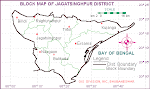
Jagatsingpur got the recgnition of a district on 1st April 1994, which is situated at a distance of 60 kms. from Cuttack. Jagtsingpur district has made Orissa's literature and culture brigh There exists Paradeep Port and fertilizer factory in this district.alika, Biluakhai, Kusumi, Kuanria and Lunijhara rivers belong to this district.
..........Garh Kujanga, Jagatsinghpur, Jhankad, Paradeep and Paradeep Garh are some of the visiting places of this district.
Important Places
Paradeep Port : It is the largest port of Orissa.
Sarala Temple : It is a famous temple of Jagatsingpur district where Goddess Saraswati is worshiped as Maa Sarala . Siddheswar Parida was changed to Adikabi Sarala Das due to the blessings of goddess Sarala. It is at a distance of 15km from Jagatsinghpur town.
General Information About Jagatsinghpur District
Area 3016 Sq.Km. Forest 13.29Sq.Kms.Population 10,14,262 Literacy Rate 79.61%
Head quarter Jagatsingpur Vidhasabha seats 4 Sub division 1 Villages 1,391
Blocks 8 Grama panchayat 165 Municipality 1 Towns 2 N.A.C 2 Temperature 38.1(Max), 12.0(Min)Tahasils 4 Rainfall 1765.1mm(Avg)
Blocks 1. Biridi 2. Raghunathpur 3. Kujang 4. Tirtol 5. Erasama
6. Balikuda 7. Nuagoan 8. Jagatsingpur
Tahasils 1. Jagatsingpur 2. Kujanga 3. Balikuda 4. Tirtola
Ssubdivisions 1. Jajpur
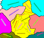
Jharsuguda became a district on 1st January 1994.Vikramakhol is situated at a distance of 26 kms. from Jharsuguda Railway Station. It is known for the cave which belongs to the 15,00 BC or even earlier. The Ib river flows through this district..Gujapahar, Kuilighugar, Pikalghugar and Vikramkhol are some of the vising places of this district.
General Information About Jharsuguda District
Area 2,200 Sq.Km. Forest 202.44Sq.Kms.Population 5,09,056 Literacy Rate 71.47%
Head quarter Jharsuguda Vidhasabha seats 6 Sub division 1 Villages 356
Blocks 4 Grama panchayat 63 Municipality 1 Towns 3 N.A.C 1 Temperature 47.1(Max), 5.5(Min) Tahasils 2 Rainfall 1216.2mm(Avg)
Blocks 1. Jharsuguda sadar 2. Laikera 3. Lakhanpur 4. Kolabira
Tahasils1. Jharsuguda 2. Laxmanpur
Subdivisions 1. Jharsuguda
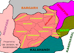
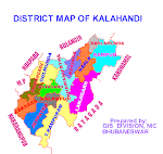
Kalahandi holds river Indravati, waterfall Ravanadhara, hot water spring Banshakela and Upper Kolab irrigation & power project. Kalahandi district is famous for some important places like Junagarh, Bhabanipatna, Karlapat, Khariar, Ambani, Belkhandi,Yogimath and Patalganga .
Important Places
Junagarh : It is situated at a distance of 27 km. from Bhabanipatna. One can see the Oriya rock edits of the Middle age at Junagarh.
Bhawanipatna : It is famous for the temple of the Goddess Minaskhi.
Karlapat : It is situated at a distance of 32 kms. from Bhabanipatna. The tourists can see the wild animals in the dense forest. The image of Goddess Kanduala attracts the pilgrims.
Khariar : It is famous for the Dhadhibamana temple.
Ambani : It is situated at a distance of 72 kms. from Bhabanipatna. The wild atmosphere attracts the tourists.
Belkhandi : It is situated at a distance of 50 kms. from Bhabanipatna .It is famous for the Shiva temple and the Museum containing the ruins.
General Information About Kalahandi District
Area 8,364 Sq.Km. Forest 2538.01Sq.Kms.Population 13,34,372 Literacy Rate 46.20%
Head quarter Bhawanipatna Vidhansabha seats 4 Sub division 2 Villages 2,205
Blocks 12 Grama panchayat 195Municipality 1 Towns 3 N.A.C 2 Temperature 49.0(Max), 10.0(Min) Tahasils 6 Rainfall 1580.3mm(Avg)
Blocks 1. Bhawanipatna sadar 2. T.Rampur 3. Dharmagarh sadar 4. Jayapatana
5. Kalampur 6. Kaksora 7. Junagarh 8. Golmunda 9. Karlamunda 10. Madanpur-Rampur
11. Narla 12. Kesinga 13. Lanjigarh
Tahasils1. Langijarh 2. Bhawanipatna 3. Dharmanagar 4. Thuamul
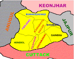
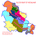
Spread over an area of 8,240 Sq.km., Keonjhar is as varied as the whole of Orissa with water-falls of various sizes and roaring gorges with rolling boulders spreading onwards to the plains of Anandapur which are a rare combination to be found else where.This district is highly rich in mineral resources and has vast deposits of Iron, Manganese and Chrome Ores.
Keonjhar, the district headquarters town, has varieties of attractions like Vishnu Temple, Jagannath Temple and on its outskirts the shrines of Siddha Jagannath, Siddha Kali and Panchabati amidst picturesque settings. Sitabinji, 30 km from keonjhar, on river Sita, is a place having ancient fresco painting on a rock shelter called Ravan Chhaya.
Check out for keonjhar district's web presence, The official Goverment web site of Keonjhar district www.keonjhar.net.
Important Places
Keonjhar district is a green land of panoramic beauties and a store house of mineral wealth. It offers a variety of attractions to the tourists which includes religious shrines, fresco painting, waterfalls and above all the exotic natural beauty. The terraced villages buzzing with the sweet melodies of the birds take the visitors to a dream land. The simplicity of the tribal folk mixed with the gaiety of their festivals can keep the visitors amused. A visit to the district will be an unforgetable experience.
Ghatagaon : 50 kms. from Keonjhar on the National Highway No.215 towards Cuttack, the place is known throughout the state for the shrine of Goddess Tarini.
Sitabinji : It is situated on the river Sita. The spot has gained prominence as a place having ancient freso paintings on a rock shelter called Ravan Chhaya which is like a half opened umbrella. The painting depicts a royal procession. It is 30 kms. from Keonjhar ( 23 Kms. on the Jajpur-Keonjhar Road upto Katrabeda and 7 Kms from there ).
Badaghagara : It is 9 kms. from Keonjhar on NH-6 towards Sambalpur, it is yet another small ( 200 ft. high) but exiting waterfall. It is one of the most popular picnic spots of Keonjhar district.
Sanghagara : It is 6 kms. from Keonjhar on NH-6 towards Sambalpur. It is a small (100 ft. high) and beautiful waterfall,suitable for outing.
Keonjhargarh : Keonjhargarh, the District headquarters is famous for the Vishnu Temple. On its out-skirts are the shrines of Sidha Jagannath, Sidhakali and Panchabati amidts picturesque settings.
Deogaon (Kosaleswar) : On the river Kusei near Anandapur. the temple of Kosaleswar built in Cicra 900 AD is a famous centre of piligrimage. Once upon a time it was a flourshing seat of Budhism. Even now a 5 feet high image of Abalokiteswar stands there as reminiscence of the Budhist activities in the past. Another important manument of the place is the stone embackment on the river which is the second of its kind in the state.
Hadagarh : The Salandi river flowing between two high mountains and a dam built over it are the main attractions for the tourists. This place is at a distance of 119km from Keonjhar.
Gonasika : Situated at a distance of 45 km from Keonjhar, Gonasika hill is the source of the river Baitarani.
Mrugamahdev : A beautiful temple dedicated to Lord Shiva, is situated on picturesque Thakurani hill. It is situated in Champua subdivision and is 65km away from Keonjhar.
General Information About Keonjhar District
Area 8,303 Sq.Km. Forest 3097.18Sq.Km.Population 15,61,521 Literacy Rate 59.75%
Head quarter Keonjhar Vidhansabha seats 10 Sub division 3 Villages 2,125
Blocks 13 Grama panchayat 244 Municipality 1 Towns 7 N.A.C 1 Temperature 43.0(Max), 5.2(Min) Tahasils 6 Rainfall 1184.4mm(Avg)
Blocks 1. Anandpur 2. Telkoi 3. Champua 4. Joda 5. Ghatagoan
6. Hatadihi 7. Harichandanpur 8. Ghasipura 9. Patna 10. Saharapada 11. Kainsipur
12. Keonjhar sadar 13. Jhumpura
Tahasils 1. Anandpur 2. Telkoi 3. Champua 4. Barbil 5. Ghantagoan 6. Hatadihi
Subdivisions1. Anandpur 2. Champua 3. Keonjhar
Kendrapada is also known as the Tulasi Khetra. Epics reveal the fact that Lord Balram killed Kenderasura here. He married his daughter Tulasi and settled here. It is one of the old districts of Orissa. This district is famous for the temple of Lord Baladev Jiew. The river Gobari flows through this district. It is also known for its spinning mills.
.........Aul, Bhitarkanika, Kendrapada and Tamala sasan are the famous tourist places.
Important Places
Kanika Palace : Kanika palace is the silent proof of glorious history of Kendrapara. King Rajendra Narayan Bhanjadeo laid the foundation stone of this palace on 9th June 1909. The palace was completed within the time period of ten years. This palace still has some antiques in it.
Vitarakanika Wildlife Sanctuary : This wildlfie Sanctuary started on 22nd April 1975. This sanctuary consists of 650 sq.km coastal area of Kendrapara, Jagatsingpur and Bhadrak district.
Dangamal : A crocodile project was established at Dangamal where there is a rare variety of crocodiles.
Gahiramatha : Gahiramatha is the breeding ground for several endangered species of sea turtles.
General Information About Kendrapada District
Area 2,548 Sq.Km. Forest 248.05Sq.Km.Population 13,01,856 Literacy Rate 77.33%
Head quarter Bhawanipatna Vidhasabha seats 4Sub division 1 Villages 1532
Blocks 8 Grama panchayat 205Municipality 1 Towns 2N.A.C 1 Rainfall 1463.6mm(Avg)
Tahasils 6 5 5
Blocks 1. Ali 2. T.Rampur 3. Pattamundai 4. Rajanagar 5. Derabisi
6. Kendrapada 7. Marshaghai 8. Mahakalapada 9. Gardpur
Tahasils1. Kendrapada 2. Aul 3. Marshaghai 4. Pattamundai 5. Rajanagar
6. Kanika
Subdivisions 1. Kendrapada
Khurda occupies a distinct place in the historical map of Orissa. Khurda was the capital of Orissa Kingdom from 1568. British government took Orissa under its rule in 1803. But it could not include Khurda in its territory till 1827. The strong protest from Paikas of Khurda shook the backbone of British rule in Orissa. Khurdagada is known as known as the "Last Independent Fort" of India. Now the remains of this historic fort lies as an evidence of our glorious past. Bhubaneswar, the capital of Orissa belongs to this district. Daya and Kuakhai rivers flow through Khurda.It is also renowned for its Brass utensils cottage industries, cable factory, spinning mill, watch repairing factory, railway coach repairing factory and oil Industry.
Important Places
Atri : It is situated at the distance of 42 k.m from Bhubaneswar .It is famous for sulfur Spring and a temple dedicated to Lord Hatakeswara.
Bhubaneswar : It is the Capital city of Orissa and the ancient Kingdom of Kalinga.Bhubaneswar popularly known as the temple city of India. The main attractions are Lingaraj temple,kedar Gouri, State museum,Bindusagar tank ,Rabindra Mandap , Ram Mandir, Raj Bhawan , Legislative Assembly , Nandankanan , parks , gardens and is the shopping center of Orissa.
Barunei : This temple is situated on the Barunei Mountain.It is at a distance of 32kms from Bhubaneswar. Goddess Barunei is the famous deity of Khurda. A beautiful stream flowing from the mountain known as Swarna Ganga doubles the beauty of this place..
Chilka : It is situated at a distance of 100kms from Bhubaneswar . It is the largest lake of the country.The lake is surrounded with scenic beauty of nature .Several types of migratory birds visit Chilka with advent of different season.It is declared as a bird sanctuary by the state govt. There are a number of rocked islands inside the , and one such picturesque island is called "KALIJAI" ,The naval training center is also situated nearby.
Dhauli : It is situated at a distance of 15kms from Bhubaneswar. The rock edict of Dhauli bears the early history of Kalinga and this rock edict was engraved by Emperor Ashok.
Khandagiri and Udayagiri : These twin hills are situated in Bhubaneswar. There are 117 caves in these twin hills. The Rani Gumpha is the largest cave in the Udaygiri hill. Another famous cave called the Hati Gumpha is also there where the rock is engraved by King Kharavela. These caves contain a beautiful Barabhuja temple and a Jain temple.
Lingaraj Temple : Lingaraj temple is the largest and most famous Lord Shiva temple in Orissa. A couple of other temples exist there around it.
NandanKanan : This is a famous Zoo of Orissa situated at a distance of 20 kms from Bhubaneswar. It is famous for the Botanical garden, zoo and the natural lake. The recently opened Natural lion safari is the largest of its kind in India. The white tigers present here makes it unique across the world.
Kaipadar : Kaipadar is situated at a distance of 15km from Khurda. A beautiful mosque is present here.This place is the meeting place of Hindus and Muslims.
Deras & Jhumka : Two beautiful picnic spots situated at a distance of 15 kms from Bhubaneswar. Deras and Jhumka are two dams surrounded by dense forest.
Shishupalgarh : Situated at a distanc eof 13kms from Bhubaneswar. The ruined fort Shishupalgarh and ancient capital of Kalinga named Toshali is being discovered by the archeological survey of India.
Shikharchandi : It is situated at a distance of 15kms from Bhubaneswar towards Nandankanan. A temple dedicated to Goddess Chandi on the hill top and the scenic beauty is the main attraction fo this place.
General Information About Khurda District
Area 2,889 Sq.Km. Forest 618.67Sq.Km.Population 18,74,405 Literacy Rate 80.19%
Head quarter Khurda Vidhansabha seats 6Sub division 2 Villages 1,567
Blocks 10 Grama panchayat 154 Municipality 1 Towns 5 N.A.C 4 Temperature 41.4(Max), 9.5(Min) Tahasils 3 Rainfall 1664.4mm(Avg)
Blocks 1. Khurda sadar 2. Balipatana 3. Banapur 4. Balianta 5. Balugaon
6. Tangi 7. Begunia 8. Jatani 9. Bhubaneswar 10. Bolgarh
Tahasils 1. Banapur 2. Bhubaneswar 3. Khurda
Subdivisions1. Bhubaneswar 2. Khurda
Some major rivers of Orissa pass through the district Koraput like Machhakunda, Bansadhara and Kolab. This district is also bestowed with waterfalls like Duduma, Bagra and Khandahati. It also contains the largest mountain of Orissa, called Deomali along with chandragiri mountain.Koraput district is famous for the important places like Jeypur, Duduma, Bagra, Sunabeda Mig factory.
Important Places
Jeypore : It is located at a distance of 21 kms from Koraput. Ruins of old palaces is the importance of this place. Darbar hall in the palace has good collection of Antique in ivory, silver, sandalwood, rosewood, gold and paintings.
Duduma : It is situated at a distance of 65 kms from Jeypore. The magnificient waterfall is regarded as the famous Machhyatirtha.
Bagra : It is situated at a distance of 9 km from Jeypore. Three waterfalls of Kolab river at Bagra starting from Kilkura or the 300feet plato jump over one another with great speed from a height of 30 feet.
Sunabeda : It is a modern township and famous for the MIG fighter plane factory. It is situated at a distance of 20km from Koraput.
Gupteswar : Situated at a distance of 65km from Jeypore, Gupteswar cave is famous for the shrine of Lord Gupteswar (Shiva). The captivating natural scenery of this place attracts the pilgrims.
Nandapur : Situated at a distance of 5kms from Koraput, Nandapur was the ancient capital of Jeypore Kingdom. The great image of Ganapati and throne with 32steps are the main attractions of this place.
General Information About Koraput District
Area 7,897 Sq.Km. Forest 1879.53Sq.Km.Population 10,51,842 Literacy Rate 36.20%
Head quarter Koraput Vidhansabha seats 4 Sub division 2 Villages 1,997
Blocks 12 Grama panchayat 197 Municipality 1 Towns 4 N.A.C 3 Rainfall 1334.6mm(Avg)
Tahasils 6 4 4
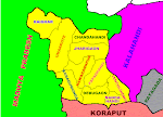
Blocks 1. Jeypore sadar 2. Kundura 3. Kotapada 4. Boriguma 5. Pattangi
6. Nandapur 7. Laxmipur 8. Similiguda 9. Baipariguda 10. Lambatraput
11. Narayanpatana 12. Dashmantpur 13. Koraput Sadar
Tahasils1. Koraput 2. Nandapur 3. Boriguma 4. Jayapur 5. Kotapada
6. Machhakunda
Subdivisions1. Koraput 2. Jayapur
Mayurbhanj was an important kingdom of Orissa even after independence. This kingdom got merged with Orissa and got the recognition of of a district on 1st January 1949. This is the largest district of Orissa in terms of area and area under forest. Mayurbhanj is a heavenly place covered with river Budhabalanga, waterfall Barehipani and mountain Meghasana. It is also recognized for its irrigation and power project named Sunei. Mayurbhanj district is famous for horn works, stone & clay works, Tussar silk, jute mills and spinning mills.
Important Places
Simillipal : The Simillipal national parks situated at a distance of 60 km from Baripada. It is spread across 2277.07sq. km. area. It is famous for the natural Wildlife sanctuary surrounded by lush green forests, springs,Mountains, and Waterfall. Tourists visit this sanctuary to watch the tigers, deers, elephants and other animals in their original habitat.
Khitching : It is the temple of Goddess Chamunda which is situated at a distance of 150 kms from Baripada. This temple is famous for its fineworks on the stone walls of the temple. Monolitheic pillars of Chaulakunj, exacaved size of Biratgarh and the museum are the visiting places.
Mantri : It is situated at a distance of 36 kms from Baripada and Known all over the state for the temple of " Kikatua Vaidyanath ".
Baripada : It is the Headquarter of the Mayurbhanj District. Ruins of ancient forts and Jagannath temple are the tourists attractions of Baripada.
Banthia Jagannath Temple : This temple is situated at Baripada. It was built by the king Sri Srinath Bhanjdeo during 1863 to 1867. Lord Jagannath is worshipped here.
Kichakeswari Temple : This temple is situated at Bahalda which is 16km away from Baripada. Bahalda was the capital of Mayurbhanj kingdom in fourteenth century. Goddess Kichakeswari is worshipped here.
General Information About Mayurbhanj District
Area 10,418Sq.Km. Forest 4392.13Sq.Km.Population 22,21,782 Literacy Rate 52.43%
Head quarter Baripada Vidhansabha seats 10 Sub division 4 Villages 3,945
Blocks 26 Grama panchayat 316 Municipality 1 Towns 1 N.A.C 3 Temperature 41.2(Max), 8.4(Min) Tahasils 7 Rainfall 1533.2mm(Avg)
Blocks 1. Baripada sadar 2. Rasgobindpur 3. Muguda 4. Suliapada 5. Betanati
6. Kuliana 7. Saraskana 8. Bangiriposi 9. Samkhunta 10. Batasahi 11. Udala
12. Badakhunta 13. Gopabandhunagar 14. Kaptipada 15. Karanjia sadar 16. Guruan
17. Sukuruli 18. Jasipur 19. Thakurmunda 20. Kusumi 21. Bisoi 22. Bijitola
23. Jamada 24. Bahalada 25. Tiringi 26. Rairangpur sadar
Tahasils 1. Baripada 2. Rairangpur 3. Betanati 4. Udala 5. Karanjia
6. Bahalada 7. Rasgobindapur
Subdivisions1. Baripada 2. Rajgangpur 3. Udala
It is a new district. This district is known for its irrigation and hydroelectricity project, called Balimela.
Balimela, Chitrakonda, Motu, Raja-Rani Bandha and Satiguda etc are some of the
visiting places of this district.
General Information About Malkangiri District
Area 6,190Sq.Km. Forest 3355.88Sq.Km.Population 4,80,232 Literacy Rate 31.26%
Head quarter Malkangiri Vidhansabha seats 2 Sub division 1 Villages 928
Blocks 7 Grama panchayat 77 Municipality 0 Towns 3 N.A.C 2 Rainfall 1465.4mm(Avg
Tahasils 3 l l
Blocks 1. Malkanagiri sadar 2. Podia 3. Mathili 4. Koraput 5. Kurukunda
6. Balimela 7. Kudamluguma
Tahasils1. Malkanagiri 2. Motu 3. Chitrakonda
Subdivisions 1. Malkangiri
It is one of the newly born districts of Orissa. This district is inhabited by aborigines, forests, natural resources and cultivable land. This district is famous for its contribution towards the national freedom movement of our country. Indravati river and irrigation & power project is one of the important places of this district.
Kelia, Papadahandi, Podagarh and Umerkote are some of the visiting places of this district.
Important Places
Sri Nilakantheswar Temple : This famous temple is situated at Papadahandi. This temple is built in the artistic style of the famous Lingaraj temple of Bhubaneswar. This temple has some Buddhist religion statues in it.
Pendrani Temple : Maa Pendrani temple is situated in Umarkot. This temple was built by king Chaitanya Dev. Maa Pendrani is the most worshipped goddess of Koraput, Kalahandi and Bolangir.
Kelia Mahadev Temple : This temple is situated on a hill named as Kelia in Debgaon tahsil. This is one of the most famous Lord Shiva temples of Orissa.
General Information About Nawarangpur District
Area 5,294 Sq.Km. Forest 2462.73Sq.Km.Population 10,18,171 Literacy Rate 34.26%
Head quarter Nawarangpur Vidhasabha seats 4 Sub division 1 Villages 897
Blocks 10 Grama panchayat 148 Municipality 1 Towns 2 N.A.C 1 Rainfall 1303.2mm(Avg)
Tahasils 4 2 2
Blocks 1. Nawarngpur sadar 2. Umarkot 3. Raigarh 4. Chandahandi
5. Papadahandi 6. Dabugaon 7. Jharigaon 8. Tentulikhunti 9. Kosagumuda
10. Nandahandi
Tahasils1. Nawarangpur 2. Umarkot 3. Kodinga
Subdivisions 1. Nawarangpur
 It is one among the old districts of Orissa. This district is known for its hotwater spring Tarable and irrigation & power project Budhbudhiani. Nayagarh is also acknowledged for its Leather works, Brass& Bell utensilsand Sugar Factory.
.............Baramul, Odagaon, Jamupatna, Kantilo, Ranapur, Sarankul, Tarabalo, Kuturi and Kuanria are some of the visiting places of this district.
Important Places
Daspalla : Situated at a distance of 40kms from Nayagarh, Daspalla is famous for Mahabir Temple. The Lankapodi festival is observed here at Dussehra.
Sukarmal : It is situated at a distance of 75 kms from Bhubaneswar under Nayagarg district . It is one beautiful scenic place for the tourists.
Sarankul : Sarankul is situated at a distance of 20kms from Nayagarh, Which is famous for Lord Ladubaba Temple.
Odagaon : It is at a distance of 13kms from Sarankul. The temple of Lord Raghunath and an Pond is the main attraction of this place. The Ramlila festival is observed here on a grand scale.
Kantilo : It is situated at a distance of 25kms from Nayagarh on the bank of river Mahanadi. The temple of Lord Nilamadhab, Lord Narayani and the scenic beauty attracts the tourists. It is also famous for Brass and Bellmetal utensils.
Ranapur : Situated at a distance of 30 kms from Nayagarh, Ranapur is a picnic spot. The temple of Goddess Maninageswari on the picturesque Maninag hill top attracts the tourists.
General Information About Nayagarh District
Area 4,242Sq.Km. Forest 2080.97Sq.Km.Population 8,63,934 Literacy Rate 71.02%
Head quarter Nayagarh Vidhasabha seats 5 Sub division 1 Villages 1,694
Blocks 8 Grama panchayat 143 Municipality 0 Towns 3 N.A.C 2 Rainfall 1513.2mm(Avg)
Tahasils 4 . .
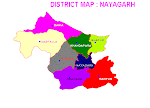
Blocks 1. Nayagararh sadar 2. Rampur 3. Nuagaon 4. Dasapalla 5. Gania
6. Khandapada 7. Bhapur 8. Odagaon
Tahasils1. Nayagarh 2. Dasapalla 3. Khandapara 4. Ranapur
Subdivisions1. Nayagarh
It was separated from Kalahandi to work as a new district recently. The rivers Udayanti and Sundar flow through this district.
.............Budhikomna, Patalaganga, Patora, Sindursil, Thipakhol and Yogimatha are the names of tourist places of this district.
Important Places
Yogimath : It is situated at a distance 9km to the east of Khariar. It is famous for the pre-historic cave paintings.
Patalaganga : At a distance of 40 km from Khariar, Patalaganga is known for its perenial spring of mineral water.
General Information About Nuapada District
Area 3,408 Sq.Km. Forest 1849.69Sq.Km.Population 5,30,524 Literacy Rate 42.29%
Head quarter Nuapada Vidhansabha seats 2 Sub division 1 Villages 659
Blocks 5 Grama panchayat 93 Municipality 0 Towns 2 N.A.C 2 Rainfall 764.6mm(Avg)
Tahasils 1 . .
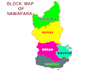
Blocks 1. Nuapada sadar 2. Sinapali 3. Komna 4. Jonki 5. Boron
Tahasils 1. Nuapada
Subdivisions 1. Nuapada
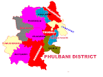
Phulbani ,the headquarter of Kandhamal district, has variety of attractions with a rich Tribal culture. Balaskumpa, 18 km from phulbani houses goddess Barala Devi .Putudi is a place of natural beauty having a charming waterfall . Chakapada is renowned for the Temple of Lord Birupaksha and the leaning trees on the river Brutunga. Charisambhu, otherwise known as Jagati, has the temple of Lord Charisambhu Ananta Vishnu. Daringi badi, nick named as the Kashmir of Orissa , is an ideal Summer Resort . Amidst dence forests ,Belghar is a place for viewing colourful wildlife, especially elephants.
.Balaskumpa, Belghar, Chakapada, Daringibadi and Putudi etc are the places of tourist interest.
Important Places
Chakapada : It is situated at a distance of 60 kms from Phulbani. It is famous for Lord Birupakhya temple .
Putudi : It is situated at a distance of 15 km from Phulbani .It is famous for the picturesque waterfall.
Puruna-cuttack : It is situated at a distance of 40kms from phulbani. It is famous for Goddess Bhairabi temple .
Daringibadi : It is called the Kashmir of Orissa. It is a hill station surrounded by dense forest.
Chari sambhu : This place is famous for Bishnu temple.
General Information About Kandhamal District
Area 7,650 Sq.Km. Forest 5709.83Sq.Km.Population 5,46,281 Literacy Rate 52.95%
Head quarter Phulbani Vidhnasabha seats 3 Sub division 2 Villages 2,515
Blocks 12 Grama panchayat 144 Municipality 0 Towns 2 N.A.C 2 Temperature 42.6(Max), 1.3(Min)Tahasils 4 Rainfall 1754.7mm(Avg)
Blocks 1. Phulabani sadar 2. Baliguda sadar 3. Raikia 4. Tikabali
5. Kotagarh 6. Chakapada 7. Nuagaon 8. G.Udayagiri 9. Tumbadibandh
10. Khajuriapada 11. Phiringia 12. Daringibadi
Tahasils 1. Baliguda 2. G.Udayagiri 3. Kandhamala 4. Daringibadi
Subdivisions 1. Phulabani 2. Baliguda
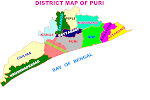
Puri, occupies a distinct place in the tourist map of India. It is situated at a distance the 62 km. from Bhubaneswar on the coast on Bay of Bengal. It is world famous for the Lord Jagannath Temple and the Car festival. Researchers say that Jesus Criest, Guru Nanak, Srichand, Sankaracharya, Ballavacharya, Tulsi Das, Kabir, Srichaitanya had visited this place and had left behind some sweet memories. The Narendra Tank , Bimala temple, Indradumna Tank, Sunar Gauranga, Gundicha Temple, Swarga Dwar, Mutimandap, Koili Baikuntha, Sankaracharya Matha, Emarnath library, Sanskrit University and a charming sea beach are some of the noteworthy places of Puri. Puri is the health and summer resort of India.
.............Astaranga, Balighai, Baliharchandi, Biswanath Hill, Beleswar, Brahmagiri, Chaurasi, Chilika, Satapada, Jahaniapira, Kakatpur, Konark, Kuruma, Pipili, Puri, Raghurajpur, Ramachandi, Satyabadi and Sakhigopal etc are the visiting places of this district.
Important Places
Bramhagiri : It is situated at the distance of 25 kms from Puri. It is famous for Alarnath Temple.
Bali Harchandi : It is situated at the distance of 37 kms from Puri.It is famous for goddess Harchandi.
Konark : It is situated at the distance of 65 kms from Bhubaneswar. It is famous for Sun Temple, Nabagraha temple,the ruined temple of Chhayadevi, Archeological Museum, and Golden sea beach.
Kuruma : It is situated at a distance of 8 kms from north-east of Konark. This place is famous for Buddhist Monastry(Boudh Bihar) and there are the images of Buddha, Heruka, Avalokiteswar and Trivikaram Visnu.
Ramchandi : It is situated at the distance of 5 km. from Konark.It is a beautiful picnic spot and is famous for the Goddess Ramchandi temple.
Satapara : Satapara is situated at a distance of 50kms on Puri-Brahmagiri road on Chilika lake coast. About 60 thousand of pilgrims visit this place to watch the natural beauty of Chilika lake.
Pipili : It is situated at a distance of 40kms from Puri. This place is famous for Applique works. Thousands of pilgrims visit Pipili to purchase craft items.
Astaranga : Astaranga is situated on the seabeach, 60kms away from Puri. This is a famous fishing centre.
Sakhigopal : Sakhigopal is a pilgrim centre for the Hindus, which is at a distance of 40kms from Bhubaneswar. It is famous for the "Gopinath Temple" and "Satyabadi Bana Vidyalaya".
Beleswar : Situated at a distance of 13kms from Puri on the sea shore is famous for its scenic beauty, Beleswar Matha and Shiva Temple.
Kakatpur : It is at a distance of 65kms from Bhubaneswar and is famous for Goddess Mangala Temple.
General Information About Puri District
Area 3,051 Sq.Km. Forest 137.10Sq.Km.Population 14,98,604 Literacy Rate 78.40%
Head quarter Puri Vidhansabha seats 6 Sub division 1 Villages 1,714 Blocks 11 Grama panchayat 204 Municipality 1 Towns 4 N.A.C 3 Temperature 36.2(Max), 13.3(Min)
Tahasils 5 Rainfall 1586.1mm(Avg)
Blocks 1. Puri sadar 2. Pipili 3. Delanga 4. Kanas 5. Nimapada 6. Kakatpur
7. Astaranga 8. Brahmagiri 9. Krushnaprasad 10. Satyabadi 11. Gop
Tahasils 1. Krushnaprasad 2. Nimapada 3. Pipili 4. Puri 5. Kakatpur
Subdivisions 1. Puri
The river Bansadhara flows through this district. This district is accepted for its Ferro Maganese factory, Ferro Silicon factory, paper Mill and Sugar factory.
..............Bissam-cuttack, Chatikona, Devagiri, Hatipathar, Minajhola, Padmapur and Niyamgiri Hills are the places of tourist interest.
Important Places
Hati Pathar : Hatipathar waterfall is situated near Rayagada. The natural surrounding of this place is excellent.
Minajhola : Minajhola is a place of attraction for its scenic beauty and the confluence of three rivers and the Shiva Temple.
General Information About Rayagada District
Area 7,580 Sq.Km. Forest 2812.33Sq.Km.Population 8,23,019 Literacy Rate 35.61%
Head quarter Rayagada Vidhansabha seats 4 Sub divisions 2 Villages 2,667
Blocks 8 Grama panchayat 140 Municipality 11 Towns 4 N.A.C 2 Rainfall 1285.2mm(Avg)
Tahasils 4 . .
Blocks 1. Rayagada sadar 2. Kolanga 3. Singhpur 4. Kalyan 5. Kasipur
6. Ramnagguda 7. Padmapur 8. Gudari 9. Bisam-Cuttack 10. Muniguda 11. Chandrapur
12. Gunupur sadar
Tahasils 1. Kasipur 2. Rayagada 3. Bisam-cuttack 4. Gunupur
An ancient centre of diamond trade, Sambalpur is famous for its tie and dye textiles; folk dance and music; and also for the Hirakud Dam, one of the longest mainstream dams in the world.
It is situated at a distance of 320 km from Bhubaneswar. It is a commercial town.The Samaleswari Temple and Sambalpur University are two important places situated here.
...........Chipilima, Gudguda, Hirakud, Huma, Kendhara Ushakothi etc are the visiting places of this district.
Important Places
Burla : It is situated at distance of 16 km. from Sambalpur.Engineering Colleges and a Medical College are situated here.
Hirakud : It is situated at a distance of 15 km. from Sambalpur. The world's longest multi-purpose Dam is situated here.Gandhi minar and Jawahar minar are constructed on the top of two hills.
Huma : It is situated at a distance of 21 km. from Sambalpur It is famous for Shiva temple.
Samaleswari Temple : Maa Samaleswari temple is the famous temple of Sambalpur. Maa Samaleswari is otherwise known as the goddess of Sambalpur.
Ushakothi : This picturesque wildlife sanctuary is located at a distance of 45km to the east of Sambalpur town. Rock cut paintings can be seen in the Ushakothi cave.
Gudguda : Gudguda waterfall is situated near Kuchinda sub-division. The waterfall around the dense forest attracts the tourists.
General Information About Sambalpur District
Area 6,698 Sq.Km. Forest 3631.77Sq.Km.Population 9,28,889 Literacy Rate 67.01%
Head quarter Rayagada Vidhansabha seats 3 Sub division 3 Villages 1,325
Blocks 9 Grama panchayat 132 Municipality 1 Towns 4 N.A.C 3 Temperature 43.2(Max), 9.6(Min) Tahasils 4 Rainfall 1413.5mm(Avg)
Blocks 1. Rangali 2. Gobindapur 3. Kuchinda sadar 4. Sambalpur sadar
5. Nandideula 6. Jamankira 7. Jujumara 8. Manesar 9. Raikhol sadar
Tahasils 1. Kuchinda 2. Rairakhol 3. Rengali 4. Sambalpur
Subdivisions 1. Sambalpur 2. Rairakhol 3. Kuchinda
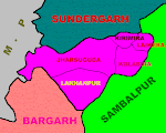
Sonepur is a newly created district,which is known as the second Varanasi of India. It is also known as the Heaven on the earth due to its natural beauty and abundance of natural resources. this district is known as the city of temples. This district has got glorified by giving birth to famous poets Bhimbhoi and Chandramani Das. This district was known as the most prosperous region as per the 1881 census. The river Mahanadi passes through this district. Sonepur is also known for its spinning mills.
..Papakhyaghat(Binika), Charada, Khaliapali, Sonepur, Chandalipat and Puja Dunguri etc are some of the visiting places of this district.
Important Places
Binica's Papakshya Ghat : This ghat is the most famous tourist spot of Subarnapur. It is said that King Ananga BhimDev got cured from Leprosy after taking bath here.
Charda : It is situated at a distance of 4 km Binika. It is famous for Kapileswar temple.
Nabagrahakunda : It is famous for the stone images of Nabgraha carved on a big stone.
General Information About Subarnapur District
Area 2,344 Sq.Km. Forest 415.7Sq.Km.Population 5,40,659 Literacy Rate 64.07%
Head quarter Sonepur Vidhasabha seats 3 Sub division 1 Villages 1,325 Blocks 3 Grama panchayat 133 Municipality 1 Towns 4 N.A.C 2 Rainfall 1637.1mm(Avg)Tahasils 4.
Blocks 1. Sonepur sadar 2. Biramaharajpur sadar 3. Ulanda
Tahasils1. Biramitrapur 2. Sonepur 3. Binaka
Subdivisions 1. Sonepur
This district is noted for its rivers Sankh, Koil and Ib. Sundaragarh district is famous for the imporant places like Rourkela, Vedavyasa, Monikmoda, Manindra Dam,Ghogar. It is rich with the resources like Steel Plant, Fertilizer Plant, Cement factory, Ferro Vanadium Plant, Machine building factory, Glass & china clay factory and Spinning mills.
...............Chhatri Hill, Darjeeng, Ghogar, Junagarh, Khandadhar, Mandira, Miriglotah, Rourkela, Veda Vyasa etc are the places of tourist interest
Important Places
Rourkela : It is the modern industrial city of Orissa.The steel plant ,fertilizer plant, IndiraGandhi Park and zoo are the visiting places
Vedavyasa : Vedavyasa is the confluence of the river Sankara and river Koel. It is 8 kms from Rourkela . This place is Legenderily associated with Maharshi Vedavyasa ,the author of the epic Mahabharat. There is a Shiva temple at Vedavyasa.
Manikmoda : There are beautiful historic rock paintings in the cave .The paintings are of animals ,birds,humans ,hunting scene.This natural cave has water resourses in it.
Manindra Dam : It is situated at a distance of 32 km. from Rourkela .Boating on the river Sankha is of another attraction.
Ghogar : It is situated at a distance of 43 kms from Sundrargarh on the river lb. It is a picturesque picnic spot .
Khandadhar : Khandadhar waterfall is located amidst the forest of Sundergarh. The height of the fall is 800metres. The magnificient sight of the fall makes a great picnic spot. The spot is 114 km from Rourkela.
Darjeeng : A beautiful picnic spot surrounded with blue mountain, spring and dense forest.
General Information About Sundargarh District
Area 9,712 Sq.Km. Forest 4957.32Sq.Km.Population 18,29,412 Literacy Rate 65.22%
Head quarter Sundergarh Vidhasabha seats 7 Sub division 3 Villages 1,744
Blocks 17 Grama panchayat 170 Municipality 3 Towns 7 N.A.C 2 Temperature 45.0(Max), 6.3(Min) Tahasils 7 Rainfall 1230.0mm(Avg)
Blocks 1. Rajgangpur 2. Sundargarh 3. Balisankar 4. Kutura 5. Tangarpali
6. Budagaon 7. Lafripada 8. Himagiri 9. Bishra 10. Nuagaon 11. Lathikata
12. Rourkela 13. Bonigarh 14. Koida 15. Lahunipada 16. Gurundia 17. Kunarmunda
Tahasils1. Panposh 2. Rajgangpur 3. Udala 4. Karanjia 5. Rasgobindapur
6. Bahalada 7. Bonai 8. Hemgiri
Subdivisions 1. Rourkela 2. Panposh 3. Sundargarh 4. Bonai